Fisheries Ecology Research
The Fisheries Ecology Lab at the Dauphin Island Sea Lab led by Dr. Sean Powers presents current research projects students and faculty are working in Mobile Bay, the Mississippi Sound, and the northern Gulf of Mexico.
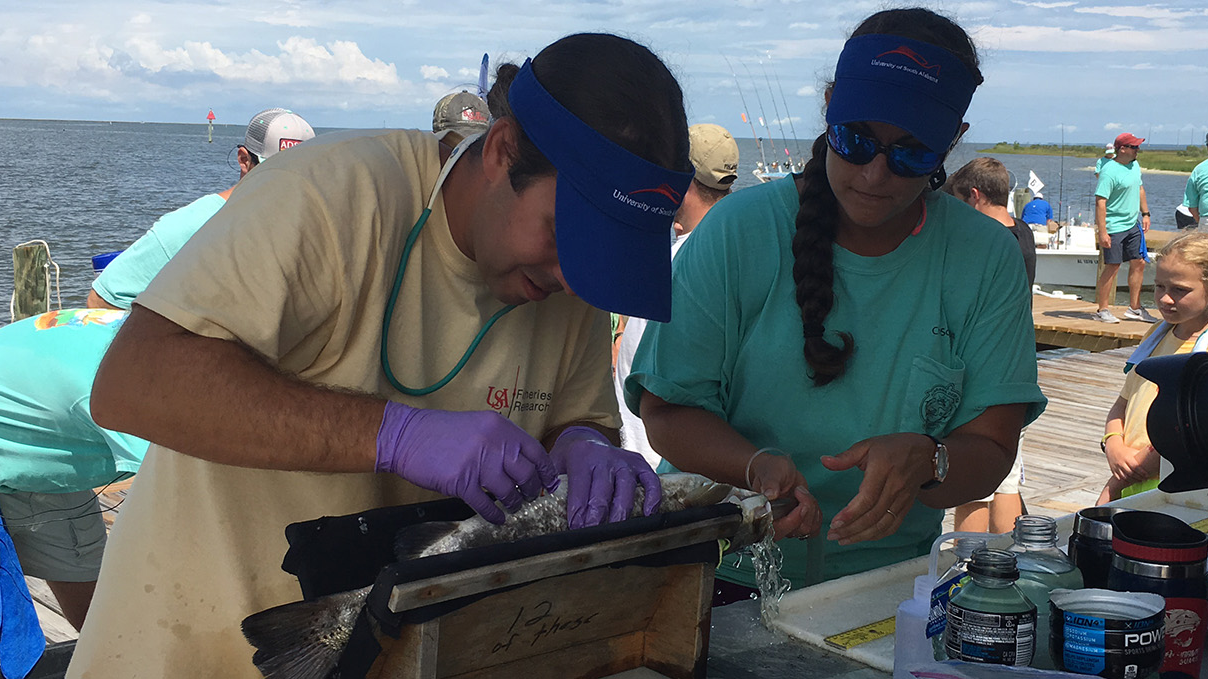
Each year, you can see the Fisheries Ecology Lab at work during the Alabama Deep Sea Fishing Rodeo held on Dauphin Island each year.
Fisheries-Independent Ecosystem Survey
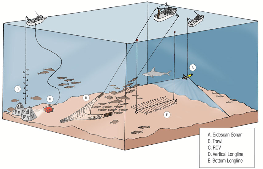
Illustration of an ecosystem-based approach to sampling reef fish communities.
Project lead:
Sean Powers, Ph.D., Principal Investigator
Background
Ecosystem-based fishery management has evolved from an abstract concept to a broadly accepted tenet for effective conservation and management of marine resources. Despite this, fishery managers are increasingly tasked with gathering more fisheries-independent data to fulfill current, single-species management objectives. Given finite resources, these two objectives are often in competition.
The goals of the fisheries-independent project are to provide a unique fisheries-independent survey design that fully addresses both ecosystem and single-species management objectives in the northern Gulf of Mexico.
Objective(s)
The objectives of the fisheries-independent project are to
- conduct a rigorous ecosystem-based assessment of reef fishes in the northern Gulf of Mexico,
- examine the relationship between reef fish assemblages and habitat attributes (natural vs. artificial vs unstructured),
- determine the selectivity of gear used in both fisheries-dependent and fisheries-independent surveys, including vertical longlines, bottom longlines, bottom trawls, and video and
- examine age composition of multiple reef fish species, particularly Red Snapper (Lutjanus campechanus).
Approach
To accomplish these objectives, we’ve divided the Alabama reef permit zone, a large offshore area encompassing most of the inner continental shelf off Alabama’s coast, into 2km2 grids, creating a depth stratified random survey sampled with multiple gears.
Following the mapping of 36 randomly selected grids each year, synoptic sampling using vertical and bottom longlines, ROV, and bottom trawls is conducted.
Results to Date
Originated as a pilot project in 2010, fisheries-independent sampling scheduled through 2020 represents our largest sampling effort to date.
Information from this survey has been collected and used for stock assessment models; for example, indices of abundance and age composition from this project were included in the most recent assessment for Red Snapper during SEDAR 31.
In addition, data from this project have been used to test the efficiency of specific gear types for sampling reef fish in the Gulf of Mexico (Gregalis et al. 2012), as well as form the basis for several graduate student research projects and pending grant proposals.
Funding Source(s)
NOAA SEAMAP, NOAA MARFIN, ALMRD, and NFWF Wildlife Sportfish Restoration Fund, and DISL.

Benthic Habitat Assessment Program (BHAP)
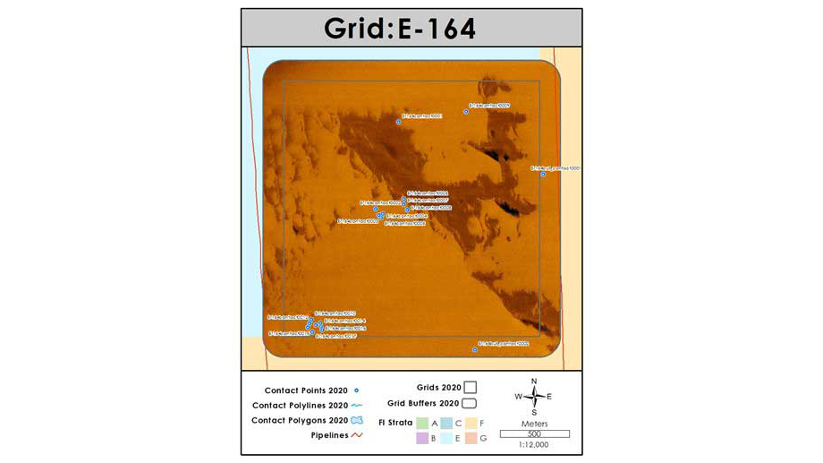
An example of a side-scan image mosaic created from a square nautical mile survey off the coast of Alabama.
Project lead
Trey Spearman, Project Manager
Background
The benthic habitat assessment program of the Fisheries Ecology Lab developed from a need to assess marine benthic habitats in an accurate and efficient manner.
Using bathymetric and side-scan sonar, benthic habitats ranging from oyster reefs, seagrass beds, and artificial and natural reef structures have been mapped in the nearshore and offshore coastal areas of Alabama since 2007.
These data are used in support of a wide variety of research projects of the University of South Alabama’s Department of Marine Sciences and the Dauphin Island Sea Lab.
Objectives
The objectives of the program are to collect and analyze sonar data to create detailed benthic habitat maps and reports as well as produce spatial data consumable by a variety of geographic information systems (GIS).
Project goals include pre and post oyster reef construction assessment, seagrass bed delineation, and offshore reef location and density estimations.
Approach
Side-scan sonar is used to create georeferenced mosaic images of large areas of the seafloor while the swath bathymetry is utilized to create high-resolution 3D imaging. The data collected from these systems are used in target detection, base image creation, and bottom classification (see image above). All data collected are stored, managed, and disseminated via a geographic information system (GIS).
Results to Date
During the course of our oyster reef surveys nearly 70 km2 of the bottom was mapped. The offshore assessment work continues, and at this point, 490+ square miles of seafloor has been mapped within and around Alabama’s Artificial Reef Permit Zones.
From this effort, the locations of over 10,000 individual reefs have been determined. The offshore assessment effort has proven to be essential in providing the sampling framework for the Fisheries Independent Survey of the Fisheries Ecology Lab.
Funding Sources
NOAA SEAMAP, NOAA MARFIN, ADCNR, DISL, and NFWF Wildlife and Sportfish Restoration Fund.
Artificial Reef Monitoring and Assessment

Project lead
Mark A. Albins, Ph.D., Research Associate
Background
Artificial reefs are often used to increase fishing opportunities, particularly in areas like the Northern Gulf of Mexico, where natural reef habitat is limited. Yet, the ecological and fisheries benefits of such reefs remain a topic of debate.
Reefs could serve to attract animals away from nearby habitats, aggregating them in known locations and thereby making them easier to catch. Reefs could also increase habitat availability and/or food resources resulting in increased production.
The Alabama Department of Conservation and Natural Resources Marine Resource Division has recently deployed a large number of new artificial reefs in the inshore and offshore waters of Alabama. These reefs have been added to an extensive existing network of artificial reefs to enhance nearshore fishing opportunities and increase the amount of high-quality habitat available for important fisheries species such as Red Snapper.
Objectives
We use fisheries-independent survey tools to assess the degree to which these new artificial reefs increase fishing opportunities and potentially result in increased fishery production.
We quantify and monitor fish and invertebrate population structure and community composition through time, in different locations, and on different reef types. Working in conjunction with researchers in the Cebrian lab whose primary focus is monitoring primary productivity on the new reefs, we hope to elucidate the links between primary production and fish production in order to shed light on the attraction-production debate and to determine whether the new artificial reefs are having the desired fishery enhancement effects.
Approach
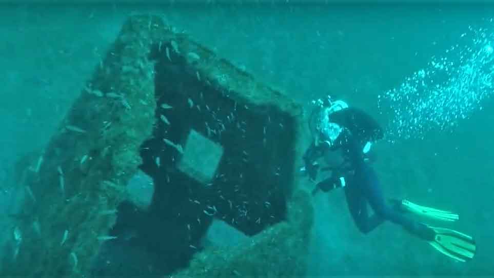
We are using a variety of standardized fishery-independent techniques to sample a subset of the newly deployed reefs. Survey tools include ROV video, vertical longline, sabiki rigs, traps, gill nets, and direct diver observations. In concert, these tools will allow us to quantify the relative abundance and biomass of a variety of species on the various reef types across depth strata and through time.
Results to Date
Baseline fish and invertebrate sampling was initiated in Spring 2016 and a surveys (post-deployment) were completed seasonally through in Fall 2018. Initial results indicate that while abundance, biomass, and diversity of fishes and invertebrates remained low through the Fall sample period, all of these metrics increased markedly between the baseline surveys and the first round of post-deployment surveys. We have seen numbers, biomass, and diversity of fishes and invertebrates to continue to increase over the past two years. Initial primary productivity sampling (Cebrian lab) was conducted in late 2016 and will also continue through the end of 2018.
Funding Sources
University of South Alabama, Alabama Marine Resources Division, Dauhin Island Sea Lab, National Fish and Wildlife Foundation

Sheepshead, Archosargus probatocephalus: population connectivity and estuarine residency as inferred from population genomics and otolith chemistry
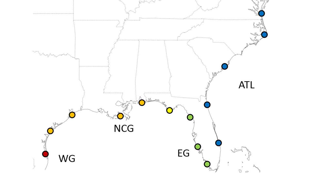
Geographic samples of our population genomic study of sheepshead
Project lead
Pearce Cooper
Background and summary of approach
The study of population connectivity and subdivision is vital to the proper management and conservation of species and furthers the study of evolutionary biology and ecology.
Sheepshead, Archosargus probatocephalus, are a euryhaline sparid fish that are ecologically, commercially, and recreationally important in the southeastern United States.
Population genetic data (microsatellite genotypes) indicate genetic divergence in sheepshead across the tip of the Florida Peninsula and both morphologic and population genetic data indicate divergence across Apalachee/Apalachicola Bay in the Florida Panhandle.
Divergence across Apalachee/Apalachicola Bay is not proximal to any known hydrographic barriers and may be maintained by divergent selection between the divergent environments/ecosystems of the fresher, turbid, and more productive north central Gulf of Mexico coastal waters and the salty, clear waters of the west coast of the Florida Peninsula.
In collaboration with the Marine Genomics Laboratory at Texas A and M University Corpus Christi, we aim to re-examine sheepshead population structure using reduced representation genomics and more extensive geographic sampling to increase the resolution of neutral population structure (see map above) and make inferences on patterns of selection by partitioning out putatively selected loci using multiple methods of genomic outlier detection.
Sheepshead are euryhaline in that they are found from the offshore marine environment to the freshwater tidal reaches of rivers.
Otolith chemistry has previously been used to describe salinity residency in euryhaline fishes as well as partition out potentially distinct life history contingents of a population within an estuary in terms of salinity residency.
We aim to use the salinity tracers of Sr/Ca and Ba/Ca, coupled with experimental validation and water sampling, to make inferences on salinity residency in sheepshead sampled in Mobile Bay in the north central Gulf of Mexico as well Apalachicola Bay, which is within an introgression zone between the north central and eastern Gulf of Mexico sheepshead populations.
As genomic data will be available for all these individuals, we will be able to examine not only whether or not there are distinct life history contingents in sheepshead but also whether or not there is any covariance between genomic data and apparent patterns of salinity residency in both an introgression zone and a single deme of sheepshead.
Objective(s)
- Examine gene flow across the managed range of sheepshead in high resolution
- Examine patterns of directional selection across this range
- Examine salinity residency of sheepshead in two major estuaries
- Determine if there is any covariance between salinity residency and genomic data within an introgression zone and a single deme of sheepshead.
Results to Date
Genomic analysis reveal strong patterns of population structure with complementarily strong patterns of putative directional selection across the range of study for sheepshead. Otolith chemical data are currently being collected.
Sources
- Vanderkooy SJ (2006) The Sheepshead Fishery of the Gulf of Mexico, United States. Gulf States Marine Fisheries Commission, Ocean Springs, MS.
- Seyoum S, McBride RS, Puchutulegui C, Dutka-Gianelli J, Alvarez AC, Panzner K. (2017). Genetic population structure of sheepshead, Archosargus probatocephalus (Sparidae), a coastal marine fish off the southeastern United States: multiple population clusters based on species-specific microsatellite markers. Bulletin of Marine Science, 93, 691-713.
- Walther BD, Limburg KE (2012) The use of otolith chemistry to characterize diadromous migrations. Journal of Fish Biology, 81, 796–825. Nims MK, Walther BD (2014) Contingents of southern flounder from subtropical estuaries revealed by otolith chemistry. Transactions of the American Fisheries Society, 143, 721–731.
- Elsdon TS, Gillanders BM (2005) Alternative life-history patterns of estuarine fish: barium in otoliths elucidates freshwater residency. Canadian Journal of Fisheries and Aquatic Sciences, 62, 1143–1152
Collaborators
Fisheries Ecology Lab at the Dauphin Island Sea Lab and University of South Alabama
Marine Genomics Lab at Texas A and M University-Corpus Christi

Building Resilience for Oysters, Blue Crab, and Speckled Trout (spotted seatrout) to Environmental Trends and Variability in the Gulf of Mexico
Project lead
Jackie Wilson, Research Technician
Background
For generations, the dynamic estuarine systems of Mobile Bay and Mississippi Sound have provided ecologically and economically important resources, upon which the livelihoods and cultural heritage of Alabama’s coastal communities rely.
Often referred to as the nursery of the Gulf of Mexico’s fertile crescent, where freshwater influx from the Alabama river delta combined with rich, saline Gulf water, create an ideal habitat for juvenile species of all phyla.
Among these, oysters (Crassostrea virginica), blue crab (Callinectes sapidus), and speckled trout or spotted seatrout (Cynoscion nebulosus) are fundamental to coastal socioeconomics, providing crucial ecosystem services including shoreline protection, commercial and recreational fisheries, working waterways for local jobs and public access, cultural experiences, and picturesque vistas sought by visitors from across the globe.
Today, populations of these species are under threat or near collapse as a result of anthropogenic activities negatively impacting the environmental conditions of Gulf estuaries.
Objective
In collaboration with the Dzwonkowski, Lehrter, and Baker labs at DISL, this project will help identify what individual or combined stressors affect these ecologically and economically important species and evaluate how management actions may improve the resilience of these populations to environmental change.
The University of South Alabama Fisheries Ecology Lab is focusing on the growth and survival of oyster populations specifically.
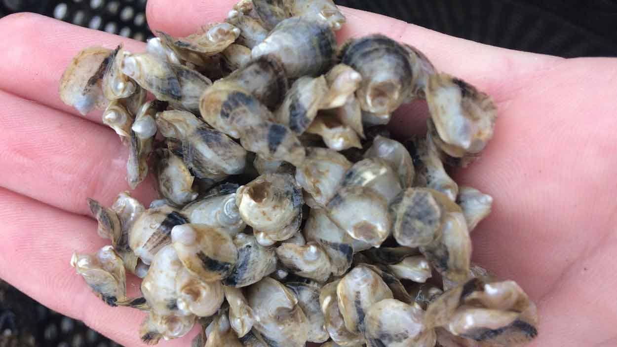
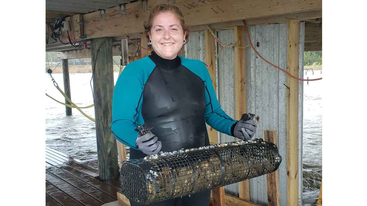
Approach
To accomplish these objectives, field observations conducted by the deployment of specialized moorings equipped with vexar mesh bags containing sample populations of diploid oyster seed at depths fixed above and below the pycnocline, at six station locations near protected oyster reefs across Mobile Bay and Mississippi Sound.
Through mesocosm experiments, from these field observations, and numerical modeling, we will quantify thresholds to identify large-scale drivers and stressors of these populations in Mobile Bay, Alabama.
In addition, numerical models will be created based on these data that can forecast population, ecosystem services, and socio-economic changes based on scenarios of future conditions.
Public preferences about changes to the ecosystem will be gauged through a survey and incorporated into the models to calculate the costs and benefits of potential management actions.
Funding
NOAA, NMFS
Effects of large-scale habitat modification on demersal fish and mobile invertebrates within Alabama’s Artificial Reef Zone
Project lead
Trey Spearman, Research Assistant
Background
South of Mobile Bay, Alabama, the Alabama Artificial Reef Zone (AARZ) covers almost 2700 km2 of the continental shelf. This area has become a hotspot for recreational and commercial fishing due to artificial reef placement.
With a growing need for both ecosystem-based fisheries management and fishery-independent data to support it, more information is needed on the demersal community residing within the AARZ.
Quantitatively examining the demersal community across this reef zone will provide data to benefit current and future ecosystem-based modeling and management.
Objectives
This study is meant to describe the demersal fish and invertebrate assemblages within the AARZ—a large area containing artificial reefs, but with relatively undisturbed habitat between structures.
The objectives are to
- assess species assemblages inside the AARZ among depths and years from 2010-2014,
- compare the demersal species assemblages from within the AARZ to those outside it, exposed to the trawl fisheries, and
- determine the relationship between demersal species and the amount of nearby artificial structure.
Approach
To accomplish these objectives the AARZ and waters immediately west were divided into 1nmi2 grids. Between 24 and 54 grids were selected each year in a depth stratified random survey from 2010 to 2014.
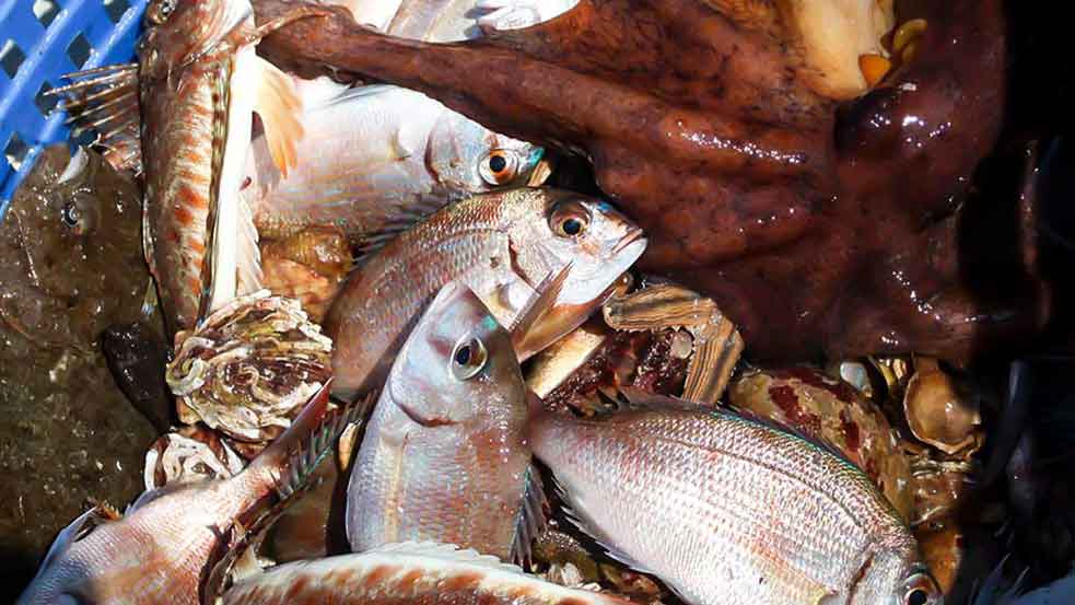
A combination of side-scanning sonar and single-beam sonar was used to map the seafloor, and then 30-minute trawl surveys were performed once per grid using the sonar map as a guide for obstacle avoidance. The catch was sorted to species (see image above), and the abundance and biomass of each was recorded.
Results to Date
Artificial reefs within the AARZ have been shown to increase the productivity of the area (promoting demersal biomass), but also show a halo effect around the reefs due to the predators feeding nearby (reducing demersal biomass).
This shows that the relationship between demersal species and nearby artificial structures is not clear-cut. This project has formed the basis for a graduate student thesis project and the results will benefit artificial reef management strategies.
Funding Sources
NOAA MARFIN, ALMRD, NFWF Wildlife, and Sportfish Restoration Fund, and DISL

Conservation and management of coastal spawning areas of yellowfin tuna in Galápagos and continental Ecuador
Project Lead
Laia Muñoz-Abril
Background
The second most fished member of Scombridae in the world is yellowfin tuna, Thunnus albacares. It is a top predator that lives in tropical and subtropical waters and some of the only teleosts that have developed physiological thermoregulation mechanisms to keep their muscles hotter than the surrounding water.
Due to the characteristics of the species and other factors such as the fishery, it has been reported that populations of yellowfin tuna from different oceans have fragmented, which constitutes a threat to the species and its habitat, as it makes them more sensitive to extinction.
Removing top predators from the marine ecosystem can cause trophic cascades and reorganization.
Ecuador is among the 10 countries that fish the most tuna worldwide and has the second-largest tuna fleet in the Eastern Pacific. Alongside fishing, there are other factors that affect commercial tuna populations: Ocean warming caused by climate change is the cause of the decrease in the productivity of marine fisheries and the potential for sustainable catches, keeping in mind that overfishing decreases the resilience of marine fish and invertebrates to climate change.
Pollutants are also part of the threats to the ecosystem. Among them, the most commonly found today are heavy metals and plastics, which have harmful effects on the species.
Objectives
The objectives of my research are to find the spawning grounds of yellowfin tuna around the Galapagos Marine Reserve, estimate the size of sexual maturity of this species, determine their reproductive seasons using a representative sample of individuals captured by the country’s industrial and artisanal fleet, and evidence the possible effects of ocean warming on the reproduction of this species using laboratory experiment with larvae.
Funding Sources
Russell E. Train Education for Nature Program, World Wildlife Fund, University of South Alabama

Evaluating Impacts of Climate Change on Flatfish Dominated Nursery Grounds
Project Lead
Dylan Kiene, Ph.D. Student
Background
Vast expanses of intertidal sand/mudflats serve as critical links in the food web of nearshore communities along the southcentral Alaska coastline. One of the largest expanses of intertidal sand/mud flats occurs in the Copper River Delta and southeastern Prince William Sound (Orca Inlet). The rich abundance of benthic invertebrates residing in the sediment provides a significant prey resource for numerous species of fish, crabs, birds, and marine mammals.
At seven stations located throughout Orca Inlet and the Western Copper River Delta, monthly otter trawl surveys were performed from April through October of 2002 – 2006. A diverse fish assemblage dominated by flatfish, sculpins, snake prickleback, and Crangon shrimp is present on the Copper River Delta.
Several of the demersal fish species and one crab species that occur within the Copper River Delta are of significant value to recreational and commercial fisheries. Pacific Halibut, Lingcod, English Sole, Starry Flounder, and Dungeness crab appear to use the extensive network of sloughs and tidal mudflats as nursery habitats. To more accurately forecast future conditions and to ensure sustainable management, scientists and managers require sound scientific information to distinguish between natural and human-induced variability.
Objectives
Understanding how climate change is affecting these juveniles which are commercially and recreationally important species is vital to the continuity of each species and the implementation of effective management strategies moving forward.
Approach
A re-evaluation of the community composition began in July 2020 by repeating otter trawl surveys at the seven stations using the same methods nearly two decades prior. In addition, an evaluation of benthic invertebrate communities that serve as prey sources is being conducted through benthic core sampling in Orca Inlet. Continued re-sampling across multiple years is vital to provide realistic forecasts of potential changes in the ecosystem.
Funding Sources
University of South Alabama

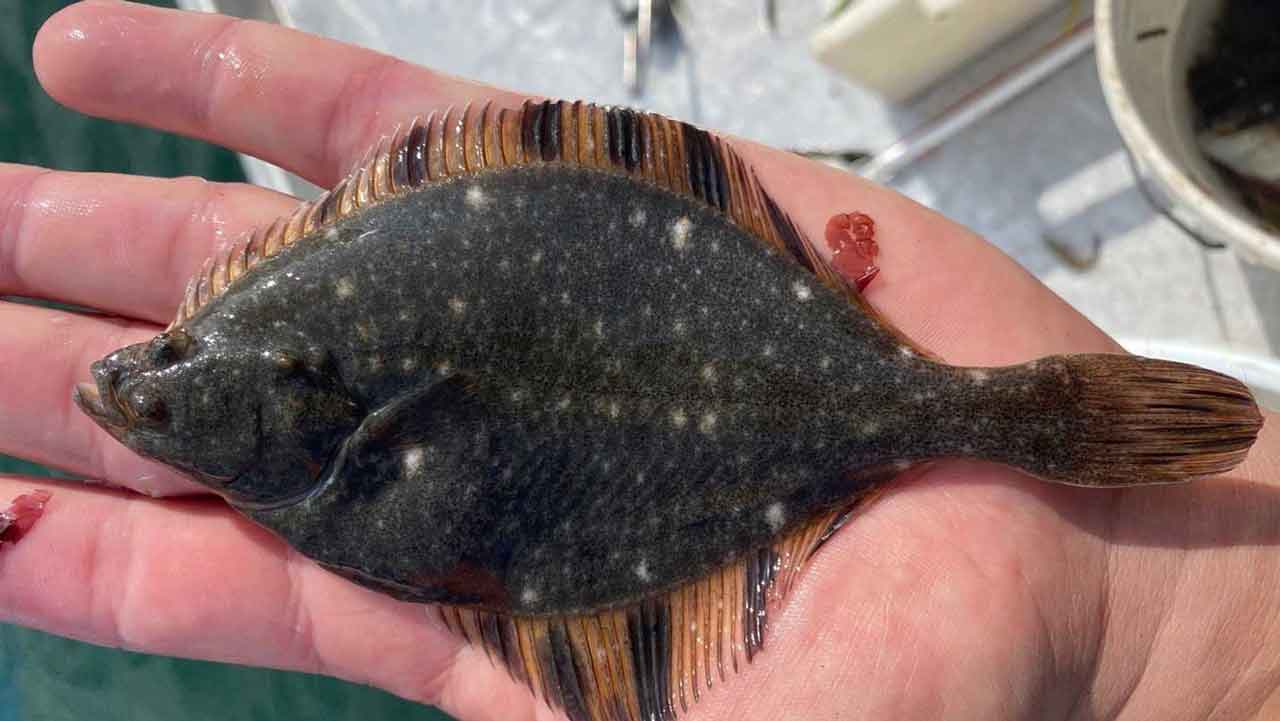
Coastal Alabama Acoustic Monitoring Program (CAAMP)
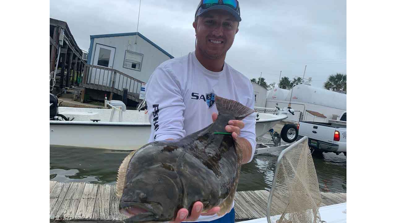
Project Lead
Dylan Kiene, Ph.D. Student
Background
The Coastal Alabama Acoustic Monitoring Program (CAAMP) is a long-standing monitoring program that has previously tracked the movement of several estuarine species including Red Drum (Sciaenops ocellatus) and Spotted Sea Trout (Cynoscion nebulosus).
In 2019 CAAMP was redesigned to study Southern Flounder (Paralichthys lethostigma). Southern Flounder exhibit sexual dimorphism - a distinct difference in the size, appearance, and life history between sexes. Male Southern Flounder typically don’t get very large (<12in) and spend most of their lives offshore, while the females grow larger and mature in the estuarine waters of the Mobile Bay area.
When female Southern Flounder reach maturity they migrate offshore during the late fall/winter to spawn.
Objectives
To determine female Southern Flounder offshore migration during later fall/winter
Approach
To quantify this migration, an array of 68 acoustic monitoring receivers was placed throughout Mobile bay and its tidal rivers. These acoustic monitors, known as hydrophones, act as underwater listening devices that hone in on the frequency emitted by acoustic tags.
Southern Flounder are fitted with acoustic tags in the early fall and tracked throughout the fall, winter, and spring months to document their spawning migration and seasonal movement patterns across size ranges and year class.
Funding Sources
Alabama Marine Resource Division, CCA Alabama, University of South Alabama

Past Projects
- Greater Amberjack Acoustic Tagging
- Fish Movement and Habitat Use
- Red Snapper Tagging
- Great Red Snapper Count
- Top-down and Bottom-up Oyster Reef Survival Success
- Age and Growth of Greater Amberjack in the Alabama Artificial Reef Zone
- Characterizing Gray Snapper (Lutjanus griseus) Life History in the Northcentral Gulf of Mexico